As the population of Delhi continues to grow, so does the need for a reliable and efficient public transportation system. The Delhi Metro is a mass rapid transit system that serves the city of Delhi and its surrounding areas. Construction on the metro began in 1998, and it has been operational since 2003.
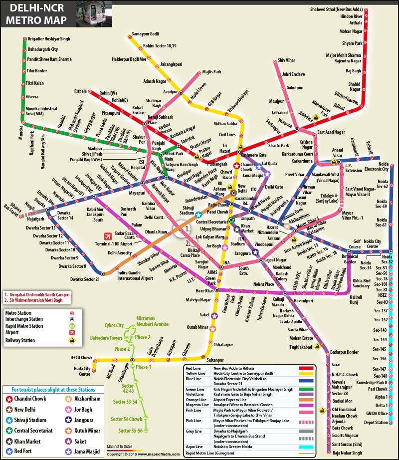
The Delhi Metro is a rapid transit system serving the National Capital Region of India. It is one of the busiest metro systems in the world which includes 11 lines, with a total length of 348 km and 255 stations. The new map makes it easy to see which stations are connected and how to get to your destination. With this handy tool, you’ll never have to worry about getting lost in the city again.
The Delhi Metro is a fast transportation network that connects the Indian cities of Delhi and the National Capital Region (NCR), which also includes Ghaziabad, Faridabad, Gurgaon, Noida, Bahadurgarh, and Ballabhgarh. Here is the latest Delhi Metro map 2023 which can be referred while travelling through it.

Leave a Reply